")
From data collection to operational decision support
During the Frøya operation, drone operations quickly evolved from being a tool for visual inspection to becoming a central source of data-driven decision support. In a situation characterized by large geographical distances, a fragmented coastline, and limited accessibility, the ability to collect, structure, and distribute data became essential for effective execution.
It was not sufficient to locate oil. The value lay in making the findings operational. Information had to be translated into decisions, prioritizations, and concrete actions in the field. This required a coherent data flow, where technology, methodology, and organization worked together.
The experience from the operation demonstrates how the integration of data solutions, automation, and artificial intelligence can deliver significant benefits in operational performance, cost efficiency, and safety.
Data collection at scale
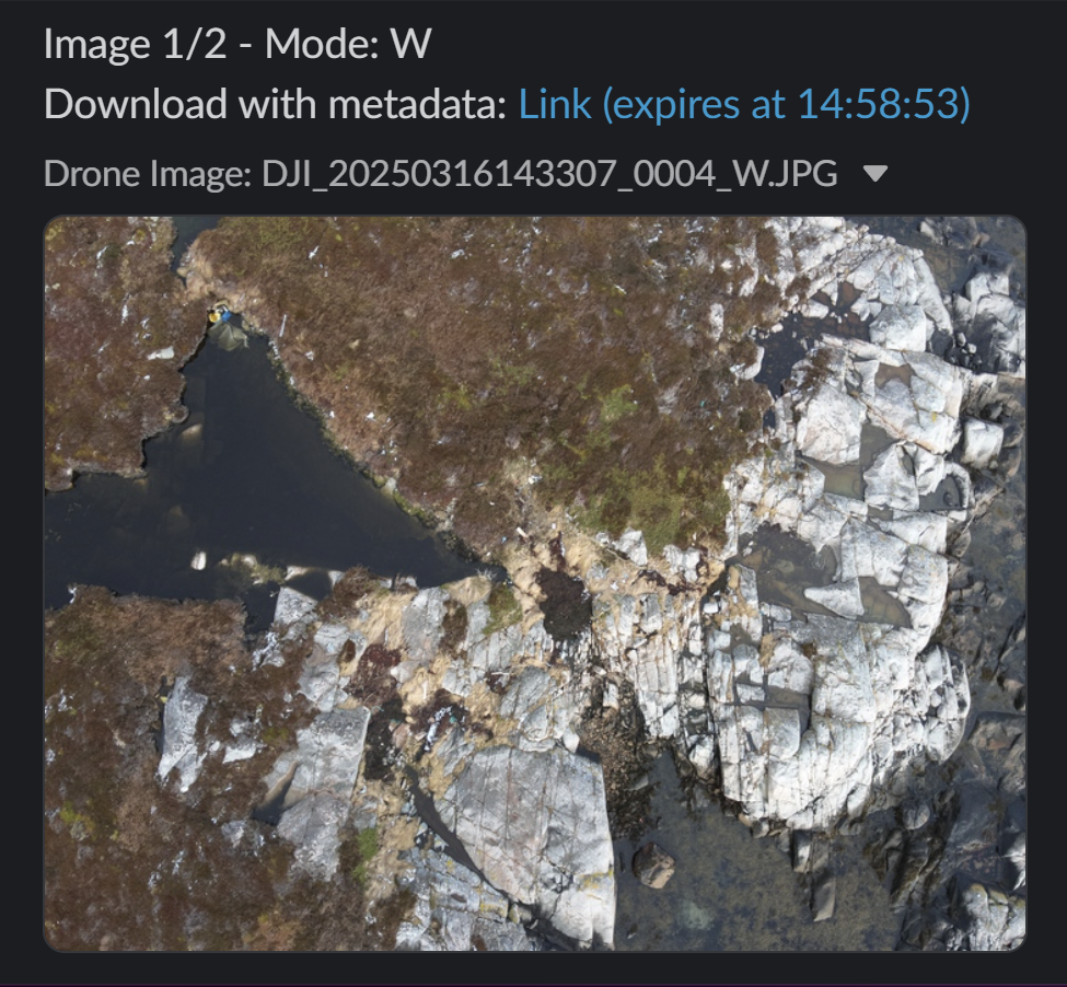
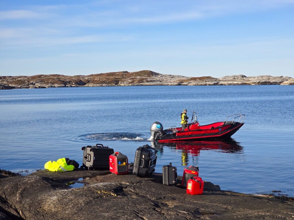
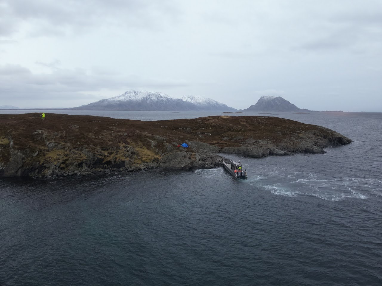
Drone operations continuously generated large volumes of data. Each flight produced a set of images and positional data that together described the condition of a given area at a specific point in time. Over time, this developed into a comprehensive dataset covering large portions of the coastline.
The challenge was to collect the right type of data in an environment with varying coverage, and to make it usable. For information to have operational value, it had to be precise, rapidly available, and understandable to multiple stakeholders simultaneously. Data needed to be usable by drone pilots, incident command, and field personnel without requiring extensive interpretation.
In the early phase of the operation, this was a limitation. Findings were shared as individual images with accompanying descriptions, often via messaging, email, or direct communication. While this enabled rapid sharing of individual observations, it lacked structure. It was difficult to establish a complete overview, and the information was hard to reuse.
As the scale increased, it became clear that data collection needed to be standardized and systematized to support an operation of this magnitude.
Integration into a common operational picture
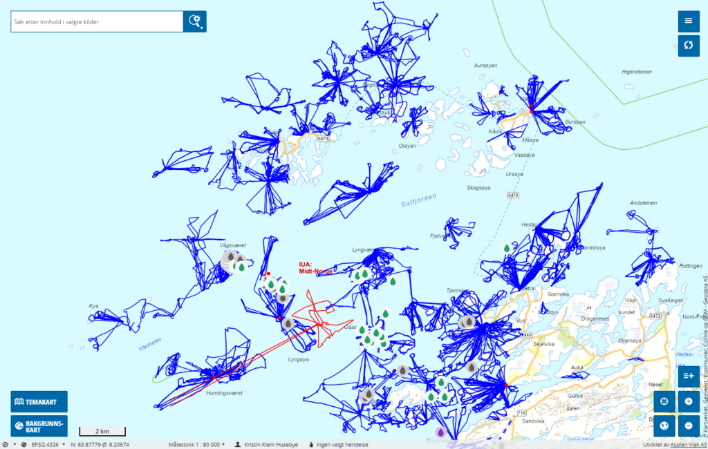
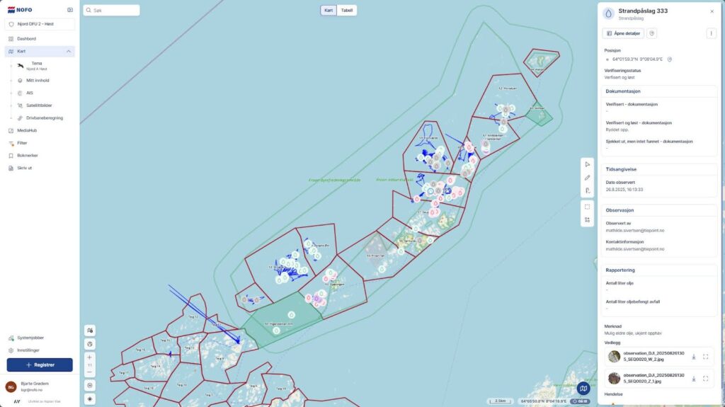
The establishment of a shared platform for data distribution and visualization marked a turning point in the operation. By linking drone observations directly to map-based systems, all stakeholders gained access to the same updated situational picture.
This fundamentally changed the dynamics of the operation.
Findings were no longer isolated observations but became part of a larger whole. It became possible to identify patterns, understand relationships, and prioritize efforts more accurately. Areas that had been surveyed could be marked as completed, while new areas could be planned based on available information.
For operational leadership, this provided significantly improved control over progress. For personnel in the field, it meant the ability to navigate directly to relevant locations with a clear understanding of what to expect.
This type of shared situational awareness reduced uncertainty and contributed to a more efficient use of resources.
Drone findings were linked to map positions, quality assured, and made available to:
- operational leadership
- field personnel
- planning resources
The result was a significant improvement in situational awareness. Instead of relying on fragmented information, it became possible to view the full picture in real time and prioritize efforts where they were most needed.
Automation of data flow
One of the most important improvements during the operation was the transition from manual to automated data handling. In the initial phase, the process was fragmented and resource-intensive. Data had to be collected, assessed, processed, and entered into systems before it could be used operationally.

This introduced delays and increased the risk of errors, particularly related to positional data and reporting quality.
By establishing an automated data flow, this process was significantly improved. When an image was captured in the field, it was automatically transferred to central systems along with associated metadata. This included precise coordinates, timestamps, and relevant contextual information.
The data could then be rapidly quality assured and published in map-based systems without the need for manual intermediate processing. The effect was immediate. The time from observation to available information was drastically reduced. At the same time, consistency across the dataset improved, making it easier to compare and analyze findings across different areas and time periods.
Automation also made it possible to handle significantly larger volumes of data without a corresponding increase in staffing. This was a prerequisite for scaling the operation further.
Use of artificial intelligence in the operation
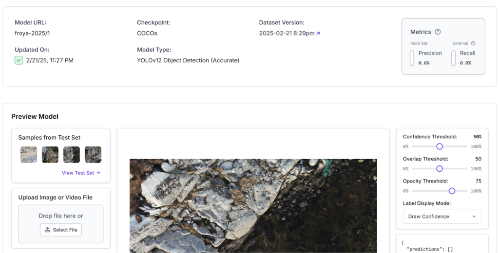

In parallel with automation, artificial intelligence was introduced to support analysis. The first models were implemented early in the operation, with limited training data and moderate accuracy.
Nevertheless, they provided immediate value as a support tool.
AI was used to identify potential oil findings in image data and provide an initial classification. This reduced the workload for personnel who would otherwise have had to manually review large volumes of imagery.
As the dataset expanded, the models improved. Accuracy increased, and AI could increasingly be used to prioritize which findings required follow-up.
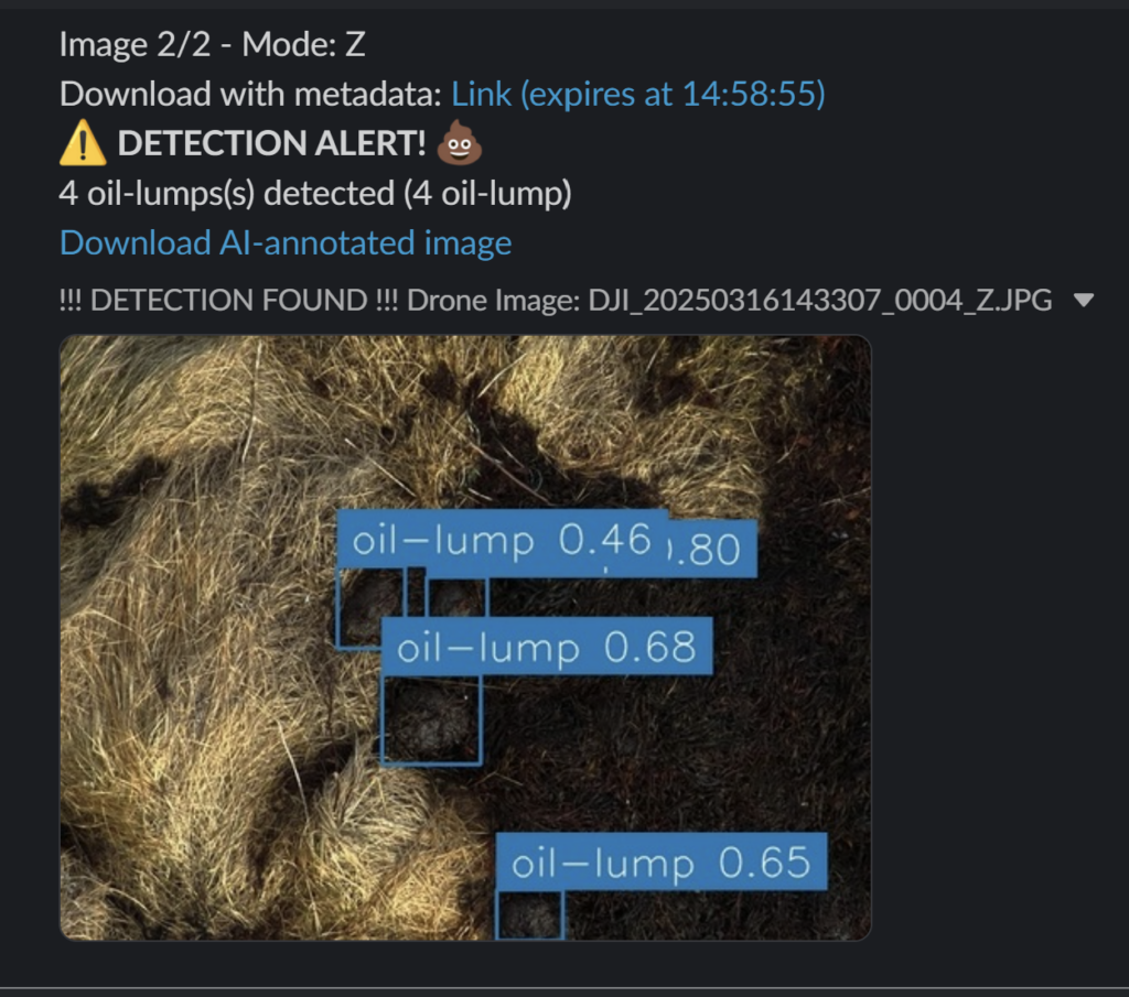
It is important to emphasize that AI did not replace professional judgment. It functioned as a filter and an amplifier, enabling faster and more consistent work. Human evaluation remained essential, particularly in complex cases where the oil had changed characteristics and was difficult to distinguish from natural materials.
From manual reporting to real-time decision support
The difference between before and after automation became evident within the first days of the operation.
In the initial phase, a finding was recorded by a pilot capturing an image, noting the position, and sending the information via message. This then had to be interpreted, manually registered, and distributed to relevant actors. In practice, it could take a considerable amount of time before the finding became operationally available to field personnel.
After automated data flow and system integration were established, this process changed fundamentally.
When an image was captured, it was automatically transferred with accurate positioning. The finding could be quickly assessed and published in map systems. Field personnel gained direct access to the location and could navigate there without intermediaries.
This reduced the time from observation to action from hours to minutes. At the same time, the quality of the information improved, and the risk of misinterpretation was reduced.
This illustrates how technology not only improves individual processes but fundamentally changes how operations are conducted.
From data to operational effect
The overall impact of data solutions became evident in how the operation evolved. As data flow was established and refined, working methods also changed.
Search efforts shifted from broad and partially random to targeted and knowledge-based. Areas with a high probability of findings were prioritized, while areas without findings could be cleared more quickly.
This led to more efficient use of both time and resources. At the same time, it became possible to document progress in a way that had not previously been achievable. Decisions could be made on a stronger basis, and adjustments could be implemented continuously.
Cost efficiency and resource savings
One of the most tangible benefits of this approach was the reduction in resource usage. By using drones and data-driven methods for systematic mapping, the need for manual fieldwork was significantly reduced.
This had several consequences. The number of hours spent on physical search decreased. The need for boat transport between islands was reduced. At the same time, personnel could be deployed more precisely where actual clean-up was required.
Overall, this resulted in clear economic benefits. Resources were used more efficiently, and the operation could be carried out with a lower overall burden than would otherwise have been necessary.
Conclusion
The Frøya operation demonstrates how data-driven methodologies can transform operational oil spill response. Through the integration of data collection, automation, and artificial intelligence, it became possible to work faster, more precisely, and with improved resource utilization.
Technology did not merely contribute to efficiency gains, but led to a fundamental change in how the operation was executed. Decisions were made on a stronger foundation, efforts were more targeted, and risks to both personnel and the environment were reduced.
The experience clearly points forward. Future oil spill response will increasingly depend on the ability to collect, interpret, and utilize data in real time.
Other stories
We keep you up to date!