How Norway’s largest drone operation was carried out
It has now been one year since Norway’s largest drone operation was conducted. This is an article series about the Frøya operation, in which Tiepoint was involved. This article focuses on the operational aspects of the response, while the next article will examine data collection and its significance.
When oil contamination from an offshore platform reached the coastline of Trøndelag and Nordland in the winter of 2025, the incident quickly developed into one of the most extensive shoreline oil spill response operations in Norwegian history. What began as isolated observations of oil lumps along the shoreline on Frøya escalated within a short period into a coordinated effort across a large geographical area.
The operation placed significant demands on operational leadership, logistics, and coordination. At the same time, it marked a clear shift in how drones are used in oil spill response. Unmanned aerial systems evolved from being a supporting tool to becoming an integrated part of the operation itself, directly influencing progress, prioritization, and resource allocation.
The incident and operational scale-up
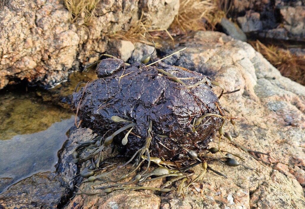
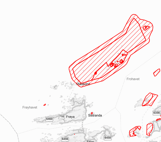
The spill off Frøya was caused by a technical failure in the separator system, where alarm systems did not activate as intended. The result was a release of approximately 75 cubic meters of crude oil. Over time, the oil drifted ashore, impacting a complex coastline with significant variation in terrain, exposure, and accessibility.
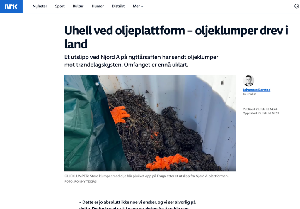
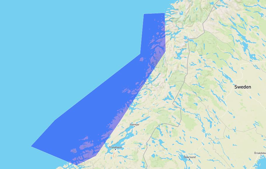
What initially appeared to be a localized incident quickly developed into a regional challenge. Oillumps was detected along a long stretch of coastline from Trøndelag and northwards, and the need for systematic mapping and prioritization of efforts increased accordingly.
The scale-up occurred both in scope and complexity. New areas had to be included continuously, while existing areas required detailed follow-up. The operation therefore evolved from being reactive to becoming planned and structured, with a clear need for coordination across disciplines and geographical zones.
Establishing drone capacity as an operational function
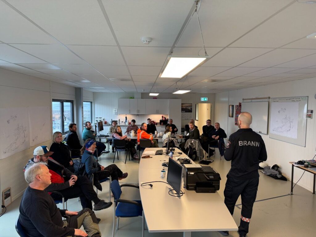
As the need for overview and progress increased, it became clear that drone capacity had to be organized as a dedicated operational function. This represented a transition from isolated drone contributions to a structured unit with dedicated leadership, clearly defined roles, and assigned responsibilities.
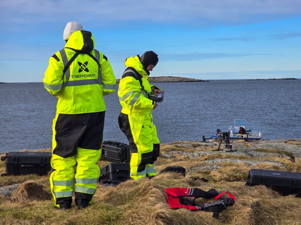
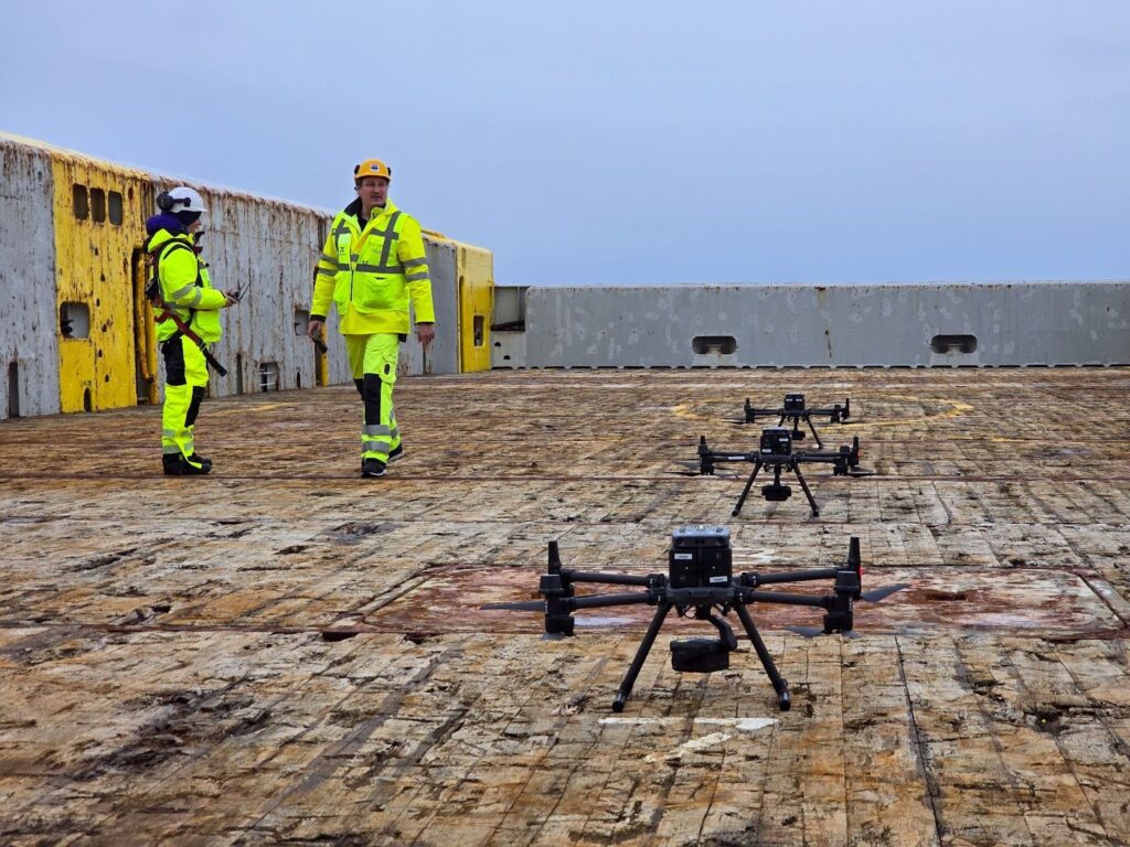
A dedicated drone organization was established, including a coordinator and an operational lead acting as the link to incident command. At this level, multiple drone teams were deployed simultaneously, each with clear roles and responsibility for defined areas.
The scaling of personnel took place in parallel with the operation. The number of teams increased rapidly, making it necessary to ensure both competence and capacity. Personnel requirements were complex, including aviation expertise, maritime experience, and operational understanding of oil spill response.
At the same time, staffing had to be organized in a way that ensured continuity and safety over time. Shift rotations, rest periods, and working environment considerations became an integral part of planning and contributed to maintaining stable operations throughout a prolonged and intensive effort.
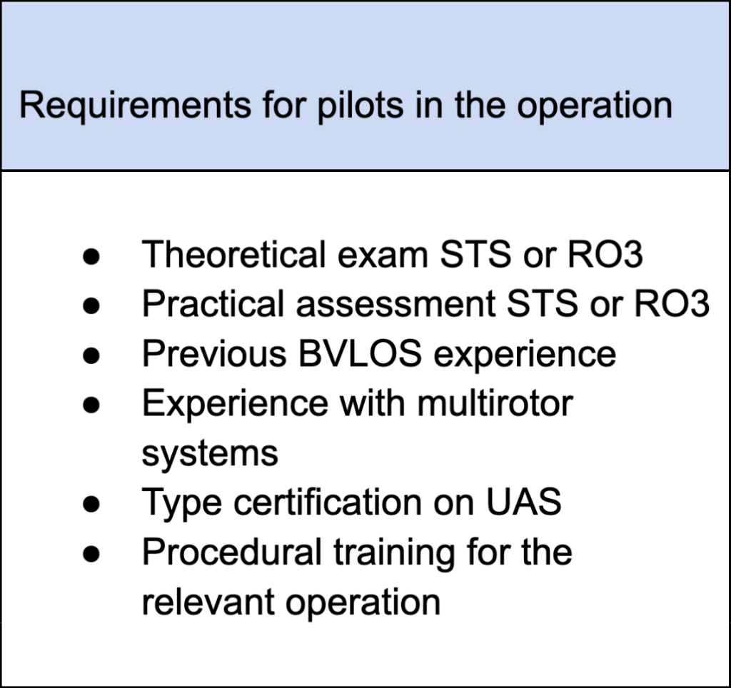
These requirements, combined with the number of pilots needed, resulted in several pilots completing practical STS assessments and platform familiarization upon arrival. All pilots underwent training in procedures and HSE.
Operational execution in a complex coastal environment
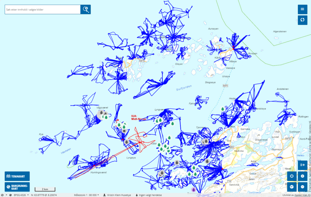
The drone operations were carried out in a demanding and highly varied coastal landscape. The operational area consisted of a large number of islands, islets, and skerries, often with limited accessibility and exposed locations.
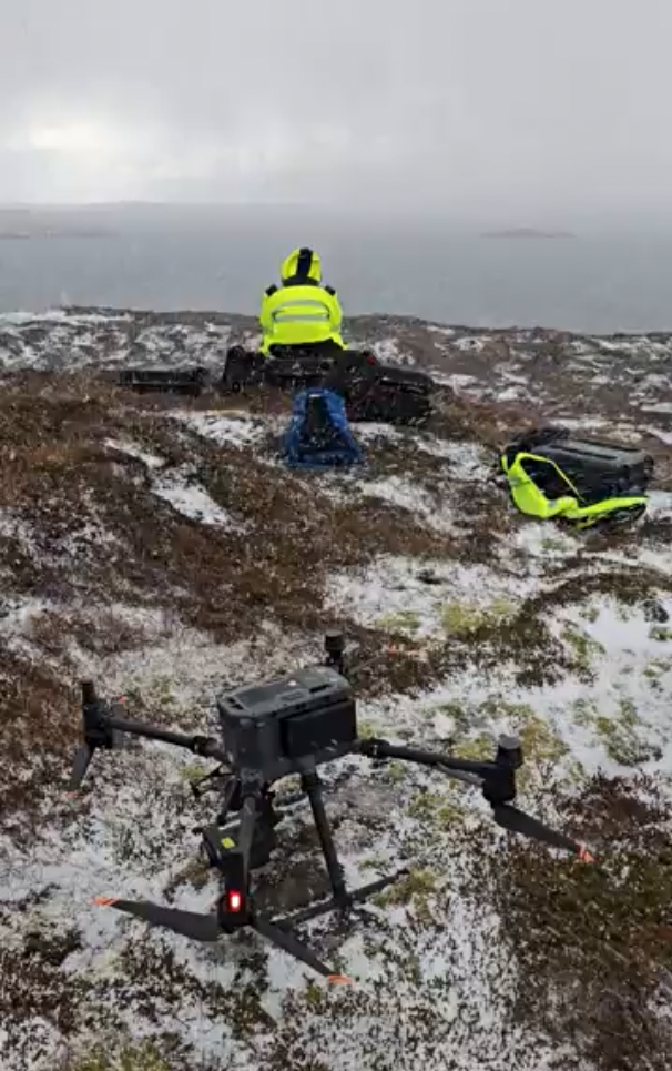
This made traditional mapping resource-intensive and, at times, hazardous. Drones were therefore used to conduct systematic searches along shorelines and in inaccessible areas, with a high degree of precision and repeatability.
High-resolution sensors enabled the identification of both distinct and more diffuse oil deposits. At the same time, the flexibility of drone operations allowed adjustments to flight altitude, speed, and search patterns based on local conditions.
An important observation was how the operation evolved over time. In the initial phase, the search was broad and exploratory, focusing on determining the extent of contamination. As knowledge increased, the effort became more targeted. This applied both to the areas prioritized and to how the search was conducted.
Operations were largely carried out without direct visual line of sight, placing demands on systems for navigation, control, and safety. Overall, this represented an operational execution with high complexity and a need for continuous adaptation.
In total, 7,900 kilometers were flown, across 2,150 flights and 700 flight hours, covering a highly extensive coastline.
Airspace coordination and safe operations
With an increasing number of simultaneous operations, airspace management became a critical factor. Multiple drones operated in parallel, often in proximity to both civilian and military air activity.
To ensure safe and predictable operations, structures for airspace coordination were established. This included the issuance of NOTAMs for operational areas, daily assessment of airspace activity, and close dialogue with relevant authorities.
Airspace management was not only a regulatory matter but became an integral part of operational planning. Each flight had to be assessed in the context of other activity, and procedures were established for continuous monitoring and communication.
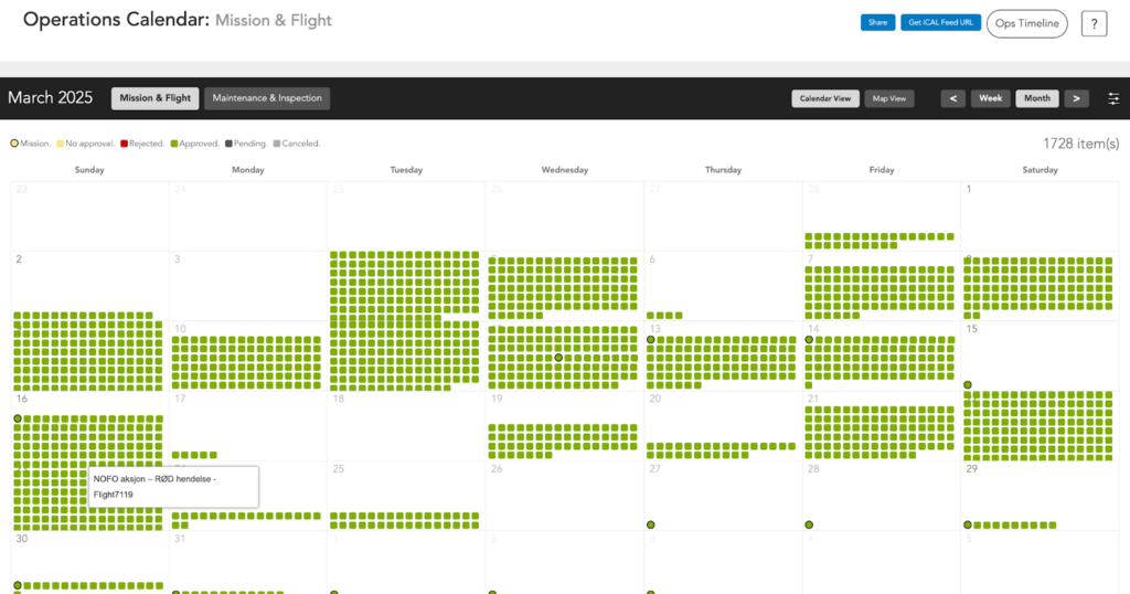
All operations were logged and reviewed afterwards. This provided both documentation and a basis for learning, while also contributing to maintaining a high level of safety throughout the operation.
Technical and operational logistics
Logistics quickly emerged as a decisive factor in the success of the drone operations. It was not sufficient to have access to drones and personnel; the entire supporting system had to function continuously.
This included accommodation, battery management, charging solutions, spare parts, and transport. In an operational area characterized by long distances and limited infrastructure, this rapidly became a complex task.
Operations from vessels introduced additional requirements. Stability, deck space, and interference from onboard technical systems had to be considered. Weather and wind conditions affected both accessibility and operational capacity, requiring continuous evaluation.
Logistics therefore became an integral part of the operational effort rather than a background support function. The ability to maintain availability of equipment and personnel was essential for the progress of the operation.
Collaboration with other actors
A key prerequisite for effective execution was close collaboration between multiple actors. Drone operations formed part of a larger system in which several disciplines and organizations worked in parallel.
Cooperation with IUA, NOFO, and overall incident command formed the basis for prioritization and allocation of resources. At the same time, interaction with SCAT teams in the field was essential for translating observations into actual clean-up actions.
Drones contributed by identifying and documenting findings, while ground crews carried out physical recovery. This division of labor enabled more efficient use of resources and reduced the need for personnel in challenging and inaccessible areas.
Over time, a shared understanding of roles, methods, and priorities developed. This improved operational flow and increased the overall effectiveness of the response.
HSE and operational safety
The reduction in the need for physical presence also had a direct impact on safety. Shoreline operations often involve movement in rugged and exposed terrain, with a significant risk of slips and injuries.
By shifting a larger portion of the mapping work to drones, this risk was reduced. Personnel could operate to a greater extent based on information rather than needing to physically access each area.
Improved situational awareness also contributed to safer operations. When personnel knew where to go and what to expect, tasks could be better planned and executed in a more controlled manner.
Environmental considerations and low-impact operations
Large parts of the operational area consisted of protected and environmentally sensitive zones. Environmental considerations were therefore an important part of the response, particularly with regard to birdlife and conservation interests. Traditional access in such areas can lead to unnecessary disturbance and environmental stress.
The use of drones made it possible to survey large areas without physical intrusion. This reduced the impact on wildlife and vegetation while still providing a comprehensive overview.
In addition, faster detection enabled earlier intervention where needed. This helped limit movement in sensitive areas and reduced the overall environmental impact.
From support tool to operational key resource
The Frøya operation illustrates a clear development in the use of drone technology in oil spill response. What has traditionally been a supplement to manual methods became a central component of the operation.
Drones made it possible to cover large areas quickly, identify findings with high precision, and document both contaminated and clean areas. This provided a stronger basis for decision-making and prioritization.
At the same time, the use of drones reduced the need for manual field mapping, increasing efficiency while improving safety for personnel.
Conclusion
The Frøya operation represents an important step in the development of modern oil spill preparedness. Through a large-scale and complex operation, it demonstrated how drones can be integrated as an operational capability alongside more traditional resources.
The combination of structured organization, effective use of technology, and close coordination made it possible to manage a demanding incident across a large geographical area.
The experience gained from the operation provides a solid foundation for further development of methodology, organization, and technology in future responses.